- Home
- Grassy Mountain Gold
- info@paramountnevada.com
- 844-488-2233
-
 Subscribe
SubscribeGrassy Mountain Project
Vale, Oregon, USA
Lattitude 38.348288
Longitude -114.680978
N 38º 20'53"
W 114º 40'51"
Overview
Overview and Location
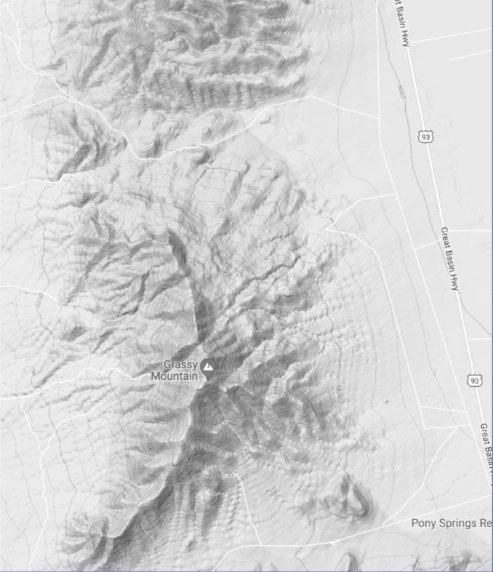
The Grassy Mountain Gold Project (“Grassy”) is Paramount Gold Nevada’s flagship asset, located in Malheur County, eastern Oregon, approximately 22 miles south of Vale and 70 miles west of Boise, Idaho. The project lies within the rolling high desert hills of the western Snake River Plain, a region with a long history of mineral exploration. The land package covers roughly 8,280 acres, consisting of 3 patented (private) lode claims hosting the deposit, 455 unpatented lode claims, 9 mill site claims, and additional leased surface and mineral rights. Paramount owns 100% of the private land where the deposit sits and controls all mining claims within the broader land package, providing secure tenure over the project area.
Since acquiring Calico Resources in 2016, Paramount has advanced Grassy with the vision of establishing Oregon’s first modern-day gold mine. The Company has significantly increased the size and confidence of its mineral resource, optimized metallurgical recoveries, and improved the project’s economic profile. These efforts culminated in the 2022 Feasibility Study, which demonstrated a profitable, high-grade, underground mine with strong returns at conservative gold and silver price assumptions.
Momentum has accelerated on the permitting front, with Grassy achieving multiple historic milestones:
2025: A Breakthrough Year
2025 has marked a turning point for Grassy, with progress across every level of permitting and regulation:
With these achievements, Paramount is well-positioned to bring Grassy Mountain into production as a low-capital, high-grade operation. Beyond its permitting progress, the Company has identified multiple near-mine exploration targets across its district-scale land package, offering the potential to extend mine life and further enhance project economics.
Feasibility Study
In October 2022, the Company filed an S-K 1300 Technical Report Summary on its Feasibility Study for the Grassy Mountain Gold Project. The study confirms a high-grade, small-footprint underground mine with strong economics that is now advancing through the final stages of state and federal permitting.
The Feasibility Study was prepared using base case prices of $1,750/oz gold and $22/oz silver.
STUDY HIGHLIGHTS
High grades: 6.5 g/t gold and 9.6 g/t silver
Permitting of Grassy Mountain
Paramount has reached historic permitting milestones across county, state, and federal levels. The most transformative development has been the inclusion of Grassy Mountain in the federal FAST-41 program in 2025, which has accelerated the timeline for federal approvals and provided a transparent framework for completion.
In addition, the State of Oregon has now issued the Draft Consolidated Permit Package for the project — the first time any mining project has reached this stage under Oregon’s consolidated permitting framework.
County Level
At the county level, Malheur County granted Paramount the Conditional Use Permit (CUP) for Grassy Mountain in 2019, following unanimous approval from the Planning Commission. The CUP reflects strong community and local government support and has since been extended through July 2027, ensuring the project remains in good standing. The permit includes requirements for fire protection, security planning with the sheriff’s office, county-approved road access, and reclamation plan approval prior to mining. These conditions underscore the county’s continued partnership in advancing Grassy toward construction.
State Level
Paramount submitted its Consolidated Permit Application (CPA) in November 2019, supported by 22 baseline data reports. In February 2020, DOGAMI and the Technical Review Team (TRT) found the initial CPA submission incomplete and requested additional information. After supplemental responses were provided, in 2023 Grassy became the first mining project in Oregon history to receive both a positive completeness determination and a Notice to Proceed from DOGAMI and cooperating agencies.
In October 2024, the Environmental Evaluation (EE) was approved by the TRT, advancing the project into the permit writing and drafting stage. In March 2025, state agencies voted unanimously to approve all major project design, processing, closure, and monitoring components under the Best Available Practicable and Necessary Technology (BAPNT) standard.
In December 2025, DOGAMI published the Draft Consolidated Permit Package for the Grassy Mountain Gold Project — a historic milestone representing the first draft permit package ever issued under Oregon’s consolidated mine permitting system.
The draft permits are now undergoing a formal public review process, including a DOGAMI-hosted public hearing scheduled for January 29, 2026, with written comments accepted through February 6, 2026. Following the close of the comment period, DOGAMI and cooperating agencies will prepare the Final Consolidated Permit Package, expected in early 2026.
With issuance of the draft permits, the state regulatory pathway has effectively entered its final stage.
Federal Level
Federal permitting has advanced most significantly with the inclusion of Grassy Mountain in the FAST-41 program in May 2025. This designation, reserved for projects of national importance, places Grassy on the Federal Permitting Dashboard, ensuring step-by-step public tracking, enforceable timelines, and interagency coordination to streamline reviews and eliminate duplication. The Bureau of Land Management (BLM) had already issued a Notice of Intent in March 2024, formally initiating the EIS process. With FAST-41 oversight, the BLM accelerated the release of the Draft EIS to August 2025, marking Oregon’s first-ever draft EIS for a gold mining project. The Final EIS was issued on January 29, 2026, along with the Record of Decision (ROD).
Despite this short delay, Grassy Mountain remains on one of the most expedited mining permitting timelines in the United States under FAST-41.
Summary
The FAST-41 designation has compressed the federal timeline by years, aligned agencies under a single transparent process, and created a high level of certainty around project approvals. With DOGAMI’s publication of the Draft Consolidated Permit Package and the associated public review period underway, the state process is now approaching its final decision stage.
With county approvals in place, state permits progressing toward final issuance in early 2026, and federal approvals issued on January 29, 2026, Grassy Mountain is on track to receive all key permits in early 2026.
This positions Paramount to advance toward a construction decision in 2026 — the most significant step yet in bringing Oregon’s first modern underground gold mine into production
For further information on the project, please visit the Grassy Mountain Website.
Exploration Potential
Paramount has completed a comprehensive review of historical data and a helicopter-borne magnetic and radiometric survey across its 8,200-acre land package. This work outlined multiple high-priority targets with the potential to add new mineralized material and ultimately extend mine life beyond the 8 years defined in the 2022 Feasibility Study, enhancing the already robust project economics.
Near-Deposit & Regional Targets
↵
• North Spur is located 500 ft. north of Grassy and consists of silicified structures in an area surrounded by low grade gold which was identified in historic shallow drilling. None of the drilling in this area penetrated these silicified structures.
• Dennis Folley is located about two miles north of Grassy. To date, there has been no drilling completed in this area. However, surface mapping and sampling identified strong silicified outcrops with several geochemistry anomalies that are expected to represent the surface expression of a mineralized system below.
• Wally/Wood is located approximately one mile north-northwest of the main deposit. Sinter has been seen on surface and previous shallow drilling has intersected up to 90 ft. grading 0.025 opt gold (0.71 g/t). In addition, this area has a well-defined resistivity anomaly which is similar to the anomaly identified at the Grassy deposit.
• Crabgrass is located 2.4 km southwest of the Grassy deposit and is host to a historic non-S-K 1300 compliant resource estimate of 0.6 million tonnes grading 1.35 g/t Au containing 24,473 oz Au.
• Bluegrass is another high priority target as previous shallow drilling has had positive results including 24 meters of 1.1 g/t Au.
Currently, the Company has not set a time frame to drill test the exploration targets as we are focusing our resources on the submission of the State and Federal permits.
Future Underground Exploration
While current exploration drilling is on hold as Paramount focuses resources on permitting, future underground development will unlock new opportunities. Once the mine shaft is constructed and operations begin, Paramount will be able to conduct targeted underground drilling to:
• Test extensions of the ore body at depth and along strike
• Explore nearby targets more efficiently and cost-effectively
• Potentially add significant mine life and production growth over time
This combination of near-deposit targets, regional prospects, and future underground exploration provides clear upside potential well beyond the base case mine plan.

Cautionary Note to U.S. Investors Concerning Estimates of Indicated, Inferred Resources and Reserves
This web site uses the terms “measured and indicated resources”, “inferred resources” and “proven and probable reserves”. We advise U.S. investors that while these terms are defined in, and permitted by, Canadian regulations, these terms are not defined terms under SEC Industry Guide 7 and not normally permitted to be used in reports and registration statements filed with the SEC. “Inferred resources” have a great amount of uncertainty as to their existence, and great uncertainty as to their economic and legal feasibility. It cannot be assumed that all or any part of an inferred mineral resource will ever be upgraded to a higher category. Under Canadian rules, estimates of inferred mineral resources may not form the basis of a feasibility study or pre-feasibility studies, except in rare cases. The SEC normally only permits issuers to report mineralization that does not constitute SEC Industry Guide 7 compliant “reserves”, as in-place tonnage and grade without reference to unit measures. U.S. investors are cautioned not to assume that any part or all of mineral deposits in this category will ever be converted into reserves. U.S. investors are cautioned not to assume that any part or all of an inferred resource exists or is economically or legally mineable. Under SEC Industry Guide 7 standards, a “final” or “bankable” feasibility study is required to report reserves, the three-year historical average price is used in any reserve or cash flow analysis to designate reserves and the primary environmental analysis or report must be filed with the appropriate governmental authority.
 Technical Reports

June 2022
2022-06-30 Grassy Mountain Project S-K 1300 Technical Report Summary on Feasibility Study
Resources
Mineral Resources
Classification | Tons
| Au
| Ag
| Au
| Ag
|
Measured | 21,153 | 0.017 | 0.072 | 363,000 | 1,529,000 |
Indicated | 12,902 | 0.030 | 0.115 | 392,000 | 1,480,000 |
Measured + Indicated | 34,055 | 0.022 | 0.088 | 755,000 | 3,009,000 |
Inferred | 1,151 | 0.037 | 0.109 | 42,000 | 126,000 |
Classification | Tonnes | Au
| Ag
| Au
| Ag
|
Measured | 19,190 | 0.583 | 2.469 | 363,000 | 1,529,000 |
Indicated | 11,705 | 1.029 | 3.943 | 392,000 | 1,480,000 |
Measured + Indicated | 30,894 | 0.754 | 3.017 | 755,000 | 3,009,000 |
Inferred | 1,044 | 1.269 | 3.737 | 42,000 | 126,000 |
Mineral Resources potentially amenable to open pit mining methods are reported using a gold price of US$1,750/oz, a silver price of US$22/oz, a throughput rate of 5,000 tons/day, assumed metallurgical recoveries of 80% for Au and 60% for Ag, mining costs of US$2.50/ton mined, processing costs of US$13.00/ton processed, general and administrative costs of $2.22/ton processed, and refining costs of $5.00/oz Au and $0.50/oz Ag produced. Mineral Resources potentially amenable to underground mining methods are reported using a gold price of US$1,750/oz, a silver price of US$22/oz, a throughput rate of 5,000 tons/day, assumed metallurgical recoveries of 90% gold equivalent, mining costs of US$90/ton mined, processing costs of US$30/ton processed, general and administrative costs of $15.00/ton processed, and refining costs of $5.00/oz gold equivalent produced.
The in-pit resources were then tabulated by the application of a gold-equivalent cut-off of 0.011 opt (0.38 g/T). The gold-equivalent grades were determined using a gold to silver ratio of a 106 to 1.
Processing is assumed to consist of crushing and milling followed by Carbon in Leach (“CIL”) recovery resulting in the production of a DORE bar on site.
Mineral Reserves
Classification | Tons | Au
| Ag
| Au
| Ag
|
Proven | 259,600 | 0.181 | 0.264 | 47,000 | 68,000 |
Probable | 1,651,900 | 0.202 | 0.294 | 333,000 | 486,000 |
Total Reserves | 1,911,400 | 0.199 | 0.290 | 380,000 | 554,000 |
Classification | Tonnes | Au
| Ag
| Au
| Ag
|
Proven | 235,508 | 6.206 | 9.051 | 47,000 | 68,000 |
Probable | 1,498,594 | 6.926 | 10.080 | 333,000 | 486,000 |
Total Reserves | 1,734,011 | 6.823 | 9.943 | 380,000 | 554,000 |
An underground mining scenario is assumed using mechanized cut-and-fill methods, which following ramp-up, is expected to produce 1,300–1,400 tons/day, four days a week. This mining rate will provide sufficient material for the 750 ton/day mill and processing plant to operate at full capacity for seven days a week.
The Proven and Probable Mineral Reserves for Grassy Mountain were estimated by first calculating an economic cut-off grade of 0.1 AuEq oz/t (3.43 g/T) for mining underground stopes, then using the cut-off grade to design stope shapes centered on Measured and Indicated Mineral Resource blocks with gold grades greater than or equal to the cut-off grade. All Inferred material was considered to be waste with no value or metal content. Internal and external dilution and mining recoveries (ore loss) were estimated and applied as modifying factors based on the total tonnage of material inside of the final designs.
EXPLORATION HISTORY
Previous Operators
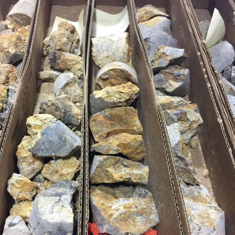
Companies and individuals involved in exploration prior to Paramount’s Project interest include prospectors Richard “Dick” Sherry and Eugene “Skip” Yates (1986), Atlas Precious Metals (Atlas) (1986 to 1992), Golden Predator Mines U.S. Inc., Newmont Exploration Ltd (Newmont) (1992-1996), Tombstone Exploration Company Ltd (Tombstone) (1998), Seabridge, and Calico (2000 to 2015). Work completed included reconnaissance, geological mapping, geochemical sampling (soil, float, rock chip), geophysical surveys (airborne magnetic and radiometric, ground-based gravity, gradient array (IP/resistivity) controlled-source audio-frequency magnetotelluric (CSAMT)), core and reverse circulation (RC) drilling, and Mineral Resource estimation. This work defined theGrassy Mountain deposit, on which a feasibility study was completed in 1990 by Atlas assuming a combined heap leach/milling operation and open pit mining methods.
Work Completed by Paramount
Since acquiring its Project interest in 2016, Paramount has conducted an exploration review of the available Project data, helicopter-borne aeromagnetic and radiometric and CSAMT ground geophysical surveys, drilling, Mineral Resource and Mineral Reserve estimation, baseline environmental studies, and mining studies.
In addition to the above exploration programs, Paramount has progressed the Grassy Mountain Project through several stages of the state and federal permitting process. The Project will require county level, state level and federal permits to construct, operate and close a mining operation.
2019: Paramount submitted its Consolidated Permit Application (“CPA”) to DOGAMI to enable the Company to build
and operate its proposed, high grade underground gold mine located in Malheur County. The Application was reviewed by the DOGAMI and cooperating agencies for completeness. As part of this process, the permitting agencies provided Paramount with a list of supplemental information and recommendations required to submit a modified CPA. Paramount, the DOGAMI and the permitting agencies continued to work together to discuss the additional information requested, ensuring the submission of a complete modified CPA which will trigger the 225 day maximum permit evaluation process, upon which draft permits are issued.
2020: the Company submitted a revised Plan of Operation (the ”PoO”) to the BLM outlining the Company’s plans to build and operate the proposed Grassy Mountain underground gold mine. The BLM has reviewed the PoO for completeness and has provided the Company with comments to address. The BLM has previously reviewed 19 of the baseline data reports (“BDRs”) and their requests for clarifications have all been addressed. The BLM will register a Notice of Intent (the ”Notice”) in the Federal Register once the application is deemed complete. The Notice initiates the Environmental Impact Statement (“EIS”) process under the National Environmental Policy Act.
2021: Paramount submitted a modified CPA with the State of Oregon and submitted a modified PoO to the BLM. Both modified applications incorporated additional information required by the regulators and mine design optimizations that were a result of feedback provided in Paramount’s initial application.
2022: Paramount completed an SK-1300 Technical Report Summary on Feasibility Study. The Company received approval of two critical BDRs from the States Technical Review Team and submitted an updated Plan of Operations to the BLM, which was subsequently deemed complete.
2023: Key state level permitting progressed further with approval of the final BDR, an extension of the Conditional Use Permit from Malheur County, and approval of the Environmental Evaluation outline. State agencies issued the completeness determination that resulted in Paramount receiving the Notice to Proceed from DOGAMI.
2024: The BLM issued a Notice of Intent, formally initiating the EIS process. The DOGAMI and BLM agreed to a coordinated, joint reclamation bond.
2025: Permitting momentum accelerated. State regulators approved all the components of Paramount’s mining, processing and closure scenarios., and the Company secured another two-year Conditional Use Permit extension. Grassy Mountain was selected for the US Government Fast-41 Program, expediting federal permitting. This led to two firsts for the State of Oregon: the BLM’s issuance of the draft Environmental Impact Statement and DOGAMI’s release of the first ever draft permit package for a modern- day gold mine.
2026: Success continued early in the year with the BLM issuing both itsr Record of Decision and the Final Environmental Impact Statement for the project.
Geology
Grassy Mountain is the largest of twelve recognized epithermal hot spring precious metal deposits of the Lake Owyhee volcanic field. The Lake Owyhee volcanic field occurs at the intersection of three tectonic provinces: the buried cratonic margin, the northern Basin and Range, and the Snake River Plain. During the mid-Miocene caldera volcanism occurred in the shallow crust throughout the region, predominately ash-flow sheets and rhyolite tuff cones. The resulting regional stratigraphic section is a thick sequence of mid-Miocene volcanic rocks and coeval-to-Pliocene age non-marine lacustrine, volcaniclastic, and fluvial sedimentary rocks.

Bedrock outcrops in the vicinity of the Grassy Mountain property are typically composed of olivine-rich basalt and siltstones, sandstones, and conglomerates of the late Miocene Grassy Mountain Formation. These rocks are locally covered with relatively thin, unconsolidated alluvial and colluvial deposits. Erosion-resistant basalts cap local topographic highs. Arkosic sandstones have been encountered at the surface and at depth, but have not been correlated across the project area, in part due to lateral discontinuity associated with sedimentary facies changes and structural offset.
The basal unit to the Grassy Mountain Formation is the Kern Basin Tuff, a non-welded, pumiceous, crystal tuff which displays cross beds and local surge structures. The Kern Basin Tuff ranges in thickness from 300 ft on the south bluffs of Grassy Mountain, to 1,500 ft in a drill hole beneath the Grassy Mountain Project area.
The Kern Basin Tuff is overlain by a series of fluvial, lacustrine, and tuffaceous sediments. Most of the sedimentary units in the project area are silicified and strongly indurated. These sedimentary units include granitic clast conglomerate, arkosic sandstone, fine grained sandstone, siltstone, and tuffaceous siltstone/mudstone. The sedimentary facies of the Grassy Mountain Formation reportedly range from 300 to over 1,000 ft thick, and provide the host rocks of the Grassy Mountain mineral resource.
Several siliceous terraces are interbedded with the silicified sediments of the Grassy Mountain Formation. Terrace construction was apparently episodic and intermittently inundated by fluvial/lacustrine sediments and ash, resulting in an interbedded sequence of siltstone, tuffaceous siltstone, sandstone, conglomerate, and sinter terrace deposits. Proximal deposits are angular, inhomogeneous, clast-supported breccias of sandstone, siltstone, and sinter with indistinct clast boundaries in a sulfidic mud-textured matrix.
Grassy Mountain is a prominent, 150 ft. high, silicified and iron-stained knob. Bedding is approximately horizontal at the hilltop, and dips at 10° to 25° to the north-northeast on the northern and eastern flanks of the hill. The bedding dip steepens to 30° to 40° on the west side of the hill due to drag folding in the footwall of the N20W striking Antelope Fault. The southwest slope of Grassy Mountain is covered by silicified arkose landslide debris.
Grassy Mountain is a horst block which has been raised 50 to 200 ft. in a region of complex block faulting and rotation. Faulting at Grassy Mountain is dominated by post-mineral N30W to N10E striking normal faults developed during Basin and Range extension. On the northeast side of the deposit, these faults progressively down-drop mineralization beneath post-mineral cover. These offsets are suggested by interpreted offsets of a prominent white sinter bed in drill holes as well as intersections with fault gouge. The N70E striking Grassy Mountain Fault shows minor vertical offset of only 10 to 40 ft.
The surface expression of the Grassy Mountain system is indicated by weak to moderately strong silicification and iron staining with scattered chalcedonic veins/veinlets. Approximate dimensions of the Grassy Mountain deposit are 1600 ft. long by 1000 ft. wide by 600 ft. thick. The deposit has a general N70 E elongation and a 15° bedding plane dip to the north-northeast as a result of faulting and fault block rotation. There is an envelope of lower grade mineralization at depths of 200 to 800 ft. which contains a higher-grade zone of mineralization between 500 and 750 ft. below the surface. The well-defined base of higher grade mineralization from about 700 to 750 ft. in depth suggests a strong pressure-temperature control on gold deposition. Sinters and breccias parallel the paleosurface present at the time of mineralization. Fractures created a stockwork pattern generally found below the sinter, though some vein extensions may extend to the surface. The stockwork is surrounded by silicified sediments.
Mineralized quartz-adularia stockwork and vein types include single, banded, colliform, brecciated, and calcite-pseudomorphed veins. Visible gold (0.5 mm) has been found within the stockwork portions of the boiling horizon. The gold mostly occurs as electrum along the fracture margins or within microscopic voids. A brassy color is imparted due to the high silver content. The average silver to gold ratio at Grassy Mountain is 2.5:1.
Silicification occurs both pervasively as silica flooding and as cross-cutting veins, veinlets and stockworks. The silicified envelope has plan dimensions of 3000 ft (N-S) by 2500 ft (E-W). Silicification is surrounded by barren, relatively unaltered, clay-rich (20-40% montmorillonite), tuffaceous siltstone and arkose with minor disseminated diagenetic pyrite. Many of the sinters occur as sheets instead of mounds, which suggests that they may be related to vents along faults rather than point sources. Potassic alteration occurs as adularia flooding with destruction of biotite. The adularia is extremely fine-grained and is identified microscopically or by cobaltinitrite staining. Sulfate phases identified by XRD include jarosite and alunite in several mineralized samples. Clast-supported breccias contain sub-rounded to sub-angular sand to boulder-sized clasts of silicified arkose and siltstone in a jarosite-sericite clay matrix.